
📊 Full opportunity report: The Eye Over The City: How Wide-Area Motion Imagery Works — And Where It Goes Blind on ThorstenMeyerAI.com — validation score, market gap, and execution plan.
TL;DR
Wide-Area Motion Imagery (WAMI) provides city-wide surveillance by capturing and archiving high-resolution images of entire urban areas. It is a powerful tool for military, border security, and disaster response, but faces limitations like weather and airspace restrictions. Its future relies on integrating with radar systems.
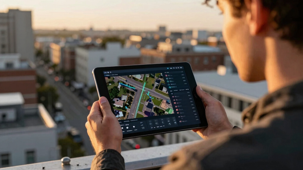
Wide-Area Motion Imagery (WAMI) is transforming urban surveillance by providing real-time, city-wide views that record and archive everything moving within several square kilometers. This technology, used by military and civilian agencies, now plays a crucial role in security, disaster response, and border protection, making it one of the most significant surveillance advances of the last two decades.
WAMI systems use an array of high-resolution cameras stitched into a single, gigapixel image, allowing analysts to monitor an entire city in real-time. The imagery is archived, enabling detailed forensic analysis—such as retracing a vehicle’s route after a crime or attack. DARPA’s ARGUS-IS, with 368 cameras, exemplifies this, offering a resolution capable of identifying objects as small as six inches from 17,500 feet altitude.
The technology’s core processing pipeline involves stabilizing the image, detecting moving objects, tracking them across frames, and archiving the data for later review. Due to the enormous data rates, human operators cannot monitor live feeds; instead, automation and AI are essential for analyzing the footage efficiently.
WAMI platforms have evolved from bulky aircraft to smaller, more versatile systems mounted on drones, helicopters, and tethered aerostats. Its deployment history includes military operations in Iraq and Afghanistan, as well as civilian applications such as wildfire mapping and disaster response, demonstrating its broad utility.
The eye over the city: how Wide-Area Motion Imagery works — and where it goes blind
A normal drone sees through a soda straw. WAMI watches an entire city at once, tracks every mover, and records it all for forensic rewind. Immense reach — with hard limits that make radar and AI its necessary partners.
- City-scale motion, fine detail
- Forensic rewind
- Cloud / smoke / dark degrade it
- Needs a platform loitering overhead
sensing
+ AI
- Sees through cloud & total dark
- Tasked over denied airspace
- Persistent, wide-area from orbit
- Sovereign · on-prem · air-gap
The same archive that traces a bomber to a safe house can trace anyone home — retroactively, without prior suspicion. Baltimore’s secret 2016 deployment led to a 2021 federal ruling that persistent aerial tracking violated the Fourth Amendment. The security value is real; so is the mass-surveillance risk. Who owns the sensor, the archive, and the AI is the accountability question.
WAMI’s power is the archive and the AI reading it; its weakness is weather, airspace, and oversight. The mature posture isn’t optical-vs-radar or capability-vs-liberty — it’s layered sensing (optical WAMI + all-weather SAR), AI-enabled exploitation, and sovereign, auditable control of the whole chain. WAMI shows what a persistent eye can do with clear skies and owned airspace; for the cloud, the night, and the denied area, the radar layer is where the resilient coverage lives.
Impacts of WAMI on Urban Security and Surveillance
WAMI’s ability to monitor entire cities continuously offers significant advantages for security and emergency management. It enhances situational awareness, aids in forensic investigations, and supports strategic decision-making. However, its reliance on optical sensors makes it vulnerable to weather conditions and airspace restrictions, raising questions about its limitations and the need for complementary systems.
This technology also prompts ongoing governance debates regarding privacy, oversight, and the potential for misuse, especially as it becomes more widespread and integrated with AI.

HXVIEW 4K PTZ Security Camera Outdoor with 50X Optical Zoom, High-Speed 360° Pan & 90° Tilt, 8MP WiFi Camera with 1200FT IR Night Vision, Auto Tracking, Person/Vehicle/Pet Detection, RTSP
50X Optical Zoom Security Camera: Equipped with a 50x optical zoom and autofocus lens, this camera allows you…
As an affiliate, we earn on qualifying purchases.
As an affiliate, we earn on qualifying purchases.
Evolution and Deployment of WAMI Technologies
The roots of WAMI trace back to early 2000s programs like Lawrence Livermore’s Sonoma Persistent Surveillance. Transitioning from experimental setups to operational systems, it was deployed in Iraq with the Army’s Constant Hawk, and later evolved into DARPA’s ARGUS-IS sensor and the Gorgon Stare pods used on Reaper drones. Over two decades, WAMI has shrunk in size and expanded in application, now serving both military and civilian needs.
Its primary mission is network discovery—tracing back attacks to their origins—and it has been used for border security, wildfire mapping, and disaster assessment. While it complements radar and other sensors, its optical nature and operational constraints define its specific role within layered sensing strategies.
“WAMI provides a city-wide, forensic view that was unimaginable a decade ago, but it depends heavily on AI to process the enormous data streams.”
— Thorsten Meyer, expert in surveillance technology

Ring Floodlight Cam Pro (newest model) — Retinal 4K with wide-angle video, 10x Enhanced Zoom, and 2000 Lumen Floodlights, 2-pack, White
More 4K coverage and light where you need it — With 2 Floodlight Cam Pro, Wired (2nd Gen),…
As an affiliate, we earn on qualifying purchases.
As an affiliate, we earn on qualifying purchases.
Limitations and Challenges Facing WAMI Deployment
While WAMI is a powerful tool, its effectiveness is limited by weather conditions like clouds and haze, which degrade optical sensors. It also requires loitering platforms within physical reach of targets, which can be contested or denied in conflict zones. Additionally, the high cost of aircraft hours and bandwidth remains a significant barrier. The integration with radar, especially in all-weather conditions, is still evolving, and operational protocols for widespread civilian use are under development.

Drone with Camera 1080HD, Features One Key Takeoff/Landing, Altitude Hold, Headless Mode, 3D Flips, Trajectory Flight,3 Speed Modes, Easy to Fly for Beginners
Powerful Brushless Motors for Superior Performance: Experience stronger wind resistance, exceptional flight stability, and significantly extended motor lifespan…
As an affiliate, we earn on qualifying purchases.
As an affiliate, we earn on qualifying purchases.
Future Developments and Integration with Radar Systems
Advances in AI will continue to improve WAMI’s automation and forensic capabilities. Efforts are underway to integrate WAMI with synthetic aperture radar (SAR) systems, enabling persistent, all-weather coverage that overcomes optical limitations. Deployment of smaller, more agile sensors on tactical drones and the expansion of layered sensing strategies are expected to enhance urban surveillance, border security, and disaster response capabilities.

Home Security Systems Alarm System for Home Security GSM/4G+WiFi | 4.3" Touch Screen | SOS | App Instant Alerts | Wireless Smart System | DIY Motion & Door Sensors | Work with Alexa | No Monthly Fee
4.3" Color Touchscreen — Security for the Whole Family. Just tap "Arm" or "Disarm". See your alarm system's…
As an affiliate, we earn on qualifying purchases.
As an affiliate, we earn on qualifying purchases.
Key Questions
How does WAMI differ from traditional surveillance cameras?
WAMI covers an entire city or large area at once, recording and archiving all movement, unlike traditional cameras that focus on a single point or small zone.
What are the main limitations of WAMI technology?
Its optical sensors are affected by weather conditions, it requires loitering platforms within reach of targets, and it generates enormous data streams that demand AI for analysis.
How does WAMI work with radar systems?
WAMI provides detailed optical imagery, while radar systems like SAR can see through weather and darkness. Combining both offers comprehensive, all-weather surveillance.
Is WAMI used only by military agencies?
While primarily developed for military and defense, civilian agencies such as fire departments and disaster response teams also use WAMI for mapping and situational awareness.
Source: ThorstenMeyerAI.com